Ideal For All
Existing Challenges
Ideal For All is a charity which enriches the lives of disabled, elderly and socially isolated people by providing therapeutic gardening, food growing, healthy cookery and training and development.
The Charity purchased a site in Wednesbury to set up a new community garden, but they had been experiencing a few issues. One of those issues was that areas of the site were prone to flooding which is not conducive to optimum growing conditions for plants and vegetables.
The site has undergone fairly extensive works which included the excavation of shrubbery, and the instatement of drainage systems throughout. With this information in mind, we conducted a site visit with Prof Mike Fullen for a more detailed investigation of the issues and to plan our scope of works in more detail.
From shallow soil samples taken on site, Prof Fullen identified a clay soil and an iron-pan, creating a groundwater gley. He predicted the gley was causing a hard or compact layer, which was inhibiting water drainage and therefore causing waterlogging.

What did we do?
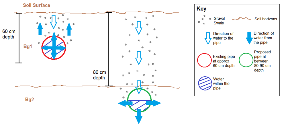
We agreed that the best course of action was to focus on the North East of the site, where the flooding is at its worst, and study the soil profile to determine the depth of the compact layer. We suspected that the current drainage system, a perforated pipe set at a depth of 60cm below the ground, was sat inside the compact layer; therefore the water was not draining out into the soil.
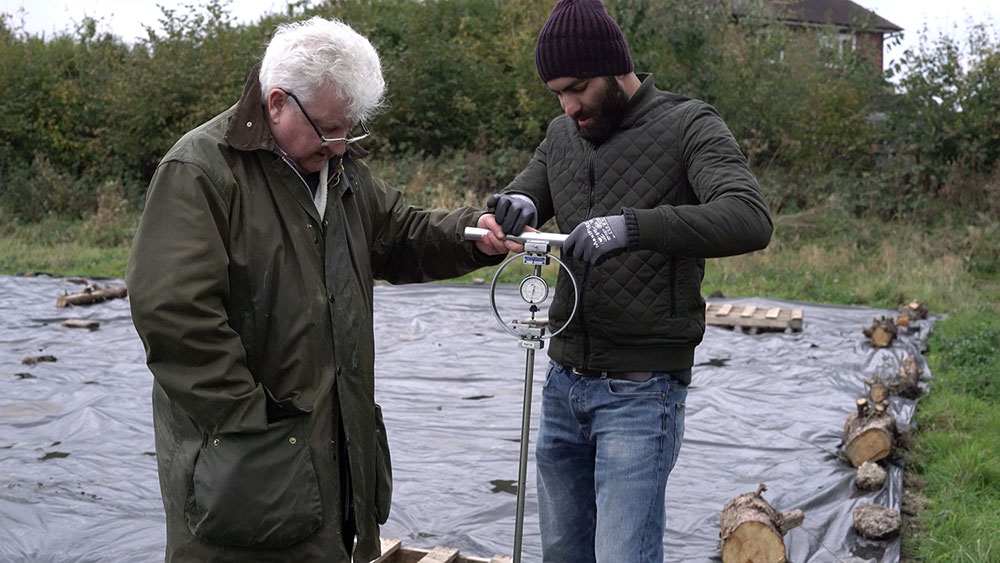
BRIC Researcher Dr Rana Khan planned points across the North Eastern edge of the site to take penetrometer readings, which helped us to determine the hardness of the soil at given depths.
Once the soil hardness had been recorded, we chose to auger a point approx. 400cm along the pipe, because this area gave readings for the shallowest point of the compact layer.
Augering is a manual process where we collect soil samples with a screw-like piece of equipment which allows us to examine the soil horizon at depths up to 2 metres below the surface. Whilst augering, we were also able to feel for ourselves where the compact layer started and ended. We laid the samples on plastic sheeting so that we could examine the soil horizon.
The Results!
With the bucket auger we took soil horizon samples all the way down to the water-table which started at a depth of 130cm. Our findings from this profile showed the compact gley soil (Bg1) horizon begins at approx. 31 cm below the surface, and the non-compact Bg2 horizon ends at approx. 84cm. Therefore, we were able to diagnose the waterlogging issue as being directly linked to the location of the drainage pipe. In order for the drainage system to perform more effectively, the perforated pipe should be re-installed at a depth of approx. 80-90 cm below the topsoil, so that the water can drain outside of the pipe. A gravel swale should be added above the pipe to meet level with the soil surface which will assist surface run off.

How can we help you?
Issues with brownfield sites can come in a variety of forms with varying degrees of severity, including soil or groundwater contamination and drainage issues, which is why it is so important to complete a preliminary site investigation. The BRIC team will complete a desktop study and visit your site in person so that we can make a well informed decision about the best way to proceed and what course of action will benefit you most before we start work.
We can work with you on short and longer term projects, so that you can get the maximum benefit from what we have to offer!


/prod01/wlvacuk/media/departments/digital-content-and-communications/images-2024/240328-Varsity-Line-Up-Resized.jpg)
/prod01/wlvacuk/media/departments/digital-content-and-communications/images-18-19/220325-Engineers_teach_thumbail.jpg)
/prod01/wlvacuk/media/departments/digital-content-and-communications/images-2024/240515-Spencer-Jones-Award-Resized.jpg)
/prod01/wlvacuk/media/departments/digital-content-and-communications/images-2024/240320-Uzbekistan-Resized.jpg)
/prod01/wlvacuk/media/departments/digital-content-and-communications/images-2024/240229-The-Link-Resized.jpg)
/prod01/wlvacuk/media/departments/digital-content-and-communications/images-2024/240516-Andy-Gibson-Resized.jpg)